About the Hampta Pass Trek
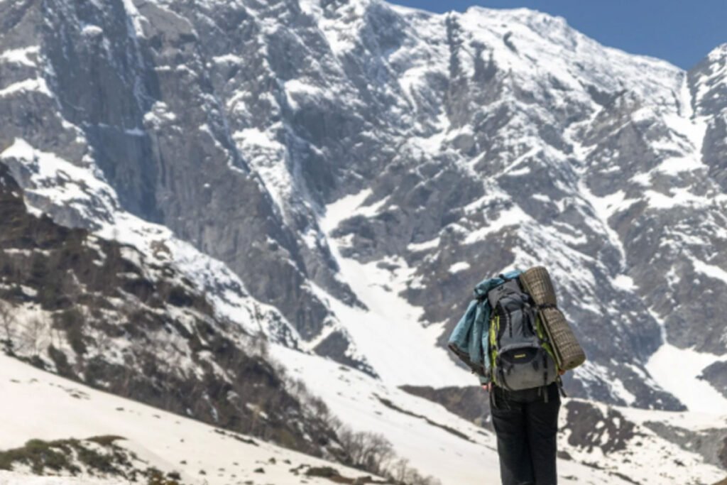
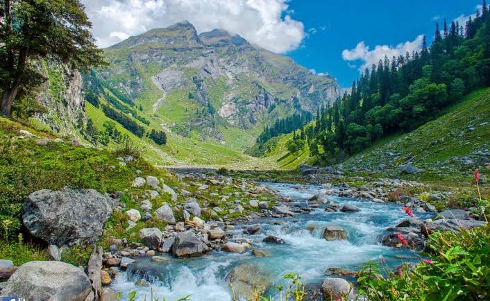
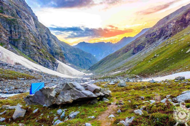
The Hampta Pass Trek is in the Kullu district of Himachal Pradesh, and the highest altitude of the trek is 14,100 feet in the Pir Panjal range. This is one of the most famous trek, where you get to see the valley of Kullu, the desert-like landscape of Lahaul, snow-clad peaks, and lakes. This is a visual delight, particularly during the monsoon season, and the visual treat between the green Kullu Valley and the desert-like Lahaul Valley along the trek. It’s perfect for adventure lovers and nature lovers.
On this trek, you get to experience the meeting of three passes, Hampta Pass, Rohtang Pass, and Spiti, and you can also connect Buddhist culture and the way of life of the remote Himalayan villages. The people of Sethan are originally Tibet and Spiti Valley migrants, and you will get to see their unique culture and practices.
Hampta Pass is a wonderful experience for nature lovers because every bend along the trek manifests a different landscape, and there would be the added thrill of taking them to the peak of a dramatic pass as in any other adventure. Hampta Pass Trek will allow you to experience 4 to 5 days of diverse landscapes with beautiful mountain views.
Best time to visit
The Hampta Pass trek, known today in popular trek not only in India but all over the world, its beauty is hidden from no one, fame retains its original form to all, Hampta Pass is this symbol of beauty, people who have special knowledge of trekking, the same people come to do this trek in the lap of this Pawan Dev Bhoomi Himachal, thousands of people come here every year in the months of July and August, this trek It is also special that it starts from Manali, the beautiful city of Himachal.
How to Reach the Base Camp
- By Road : Manali is well – connected by road, with buses and private cars available from Delhi and Chandigarh.
- By Air : The nearest airport is Kullu-Manali Airport (Bhuntar), but it’s more expensivew. Flights from Delhi are a more convenient option for international travellers.
- By Train : The nesrest railway station is Joginder Nagar Railway Station, but it’s asignificent distance from Manali.
Essential Tips for Trekking
1. Backpack : A comfortable and sturdy backpack is essential to carry all your gear and supplies during the trek.
2. Clothing : Pack warm and waterproof clothing, including thermal innerwear, a fleece jacket, a waterproof jacket, and a hat and gloves.
3. Footwear : Good quality trekking shoes are a must, as the trek involves a lot of walking over uneven terrain and extra pair of socks.
4. Hydration : A hydration system, such as a hydration bladder or water bottles, is important to stay hydrated during the trek.
5. Food and snacks : Pack enough food and snacks to last for the duration of the trek, including energy bars, dried fruits, and nuts.
Why Choose Hampta Pass Trek?
It is really essential to perceive the reason behind choosing Hampta pass trek. See firstly, the trekking distance is a total of by taxi 296 Km and on foot 29 km which is to be covered into 5 days. Manali to Jabra, cheeka, Balu ka Gera, shea Geru, Chatru, Chandratal, via rohtang pass. Hampta Pass Trek is a low altitude mountain trek Altitudes is 4310 Meters. The Starting trail is easy to moderate as compare to other treks
Frequently Asked Questions About Hampta Pass Trek
Qns. What is Hampta Pass Trekking?
Ans. Hampta Pass trek is a popular high altitude trek in the Pir Panjal mountain range of the Himalayas in Himachal Pradesh, India. It crosses the Hampta Pass at an altitude of about 14,000 feet above sea level and connects the Lahore Valley with the Kullu Valley. Where is Hampta Pass Trek?It starts from Manali in Kullu district and ends in Lahaul valley near Chaturgram. The journey passes through beautiful valleys, glaciers, high deserts and meadows.
Qns. How hard is the Hampta Pass trek?
Ans. You consider the Hampta Pass trek moderate to strenuous hike due to the high altitudes, snow patches, and some steep climbs to the top of the lake and physically demanding great ground strength and first-hand knowledge of hiking.
Qns. What is the highest point?
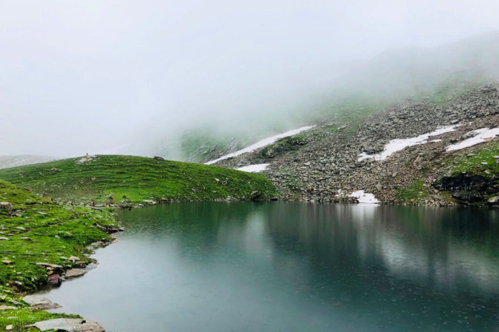
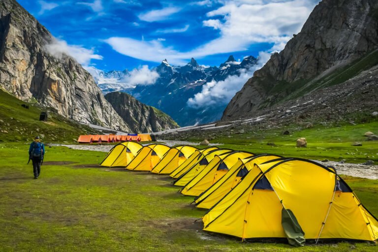
Ans. The highest point reached on the Hampta Pass trek is Hampta Pass itself, which is about 14,035 feet above sea level Are there any famous campsites along the way? Yes, the famous camping spots include Jwala, Bar Ka Gera, Siya Gol and Chatur, where trekkers often stop.
Qns. What is the Hampta pass trek height?
Ans. The highest altitude of Hampta Pass Trek with Chandratal is 14,107 ft. The Hampta Pass Trek is a popular trekking route in the Pir Panjal Range of the Himalayas, located in the Indian state of Himachal Pradesh. The highest point of
the trek is the Hampta Pass itself, which stands at an elevation of approximately 4,270 meters (14,009 feet) above sea level.
Qns: What is the Hampta pass trek distance?
Ans: The Hampta Pass Trek is a moderate to challenging trek in the Himalayan region of Himachal Pradesh, India. The total distance covered during the trek varies slightly depending on the specific route taken, but typically ranges from approximately 24 to 28 kilometers (15 to 17 miles) one way.